
5 Years of IASO, the All-In-One Georegistry, Campaign Digitization and Data Collection Open-Source Platform

Five years ago, in 2019, Bluesquare created IASO with a vision to unlock the power of geographical data to better structure and streamline data collection in support of health, environmental or social programmes in hard-to-reach and low-connectivity areas. Since then, the vision expanded to include planning and monitoring capacities, to support campaign activities, as well as entity tracking, to create for example beneficiary files for nutrition programs.
Consequently, today, IASO lends itself to many use cases, ranging from being a Georegistry, a geographical data warehouse, to supporting Campaign Digitization, including large-scale campaign planning, deployment and evaluation. Plus, IASO is available in French and English, which makes it shelf-ready in a lot of contexts!
As we celebrate IASO’s 5th anniversary, we want to summarize the key milestones that have shaped its development.
Key Developments Over the Years
IASO’s journey began in 2019, drawing from the extensive experience of a project on sleeping sickness eradication in the Democratic Republic of Congo (DRC). Launched as an open-source tool, IASO focused on geo-structured data collection taking place in remote and offline areas. One of the first significant implementations led to the update of the health pyramid in the DRC. This effort identified 1,800 community health sites, enabling crucial healthcare access information to be sent to the central Health Management Information System, a DHIS2 instance.
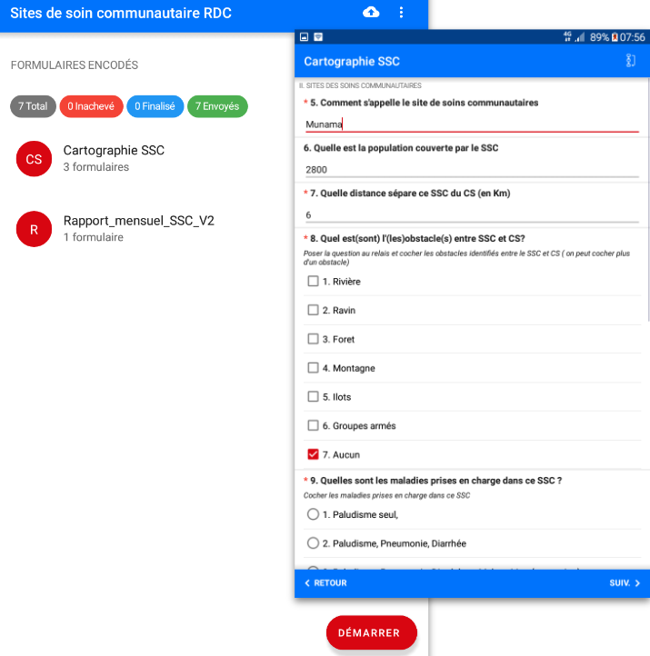
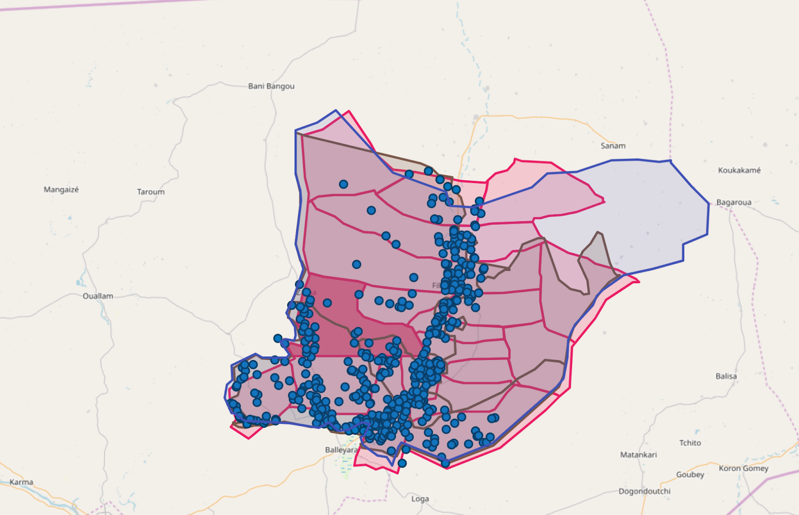
By 2020, IASO had strongly advanced in managing geospatial data, incorporating features that allowed for detailed mapping projects. One notable project was in Niger, where detailed data about 2,000 health facilities, including GPS coordinates and pictures, was collected. In the DRC, a massive schools mapping initiative identified and geolocated 109,000 schools, showcasing IASO’s capacity for extensive data collection and management.
In 2021, IASO started to be used in digitizing mass campaigns as it was adapted to support The Global Polio Eradication Initiative (GPEI) data harmonization effort across the African region, covering 47 countries and more than 160 polio vaccination campaigns. For this project, IASO’s advanced geospatial data capabilities allowed quick development of the encoding of key parameters and in particular the geographical scope of the campaigns.

In 2022, IASO’s geo-enabled micro planning features were deployed, allowing the digitalization of the 2023 nationwide measles vaccination campaign in Cameroon, resulting in the vaccination of 4.9 million children.

A bit later that year, the IASO team released entity management and workflow capacities, allowing in a first use case the tracking of nutritional programmes beneficiaries in offline settings.
And finally, in 2023, IASO supported the first introduction of the malaria vaccine in Cameroon across 42 health districts and it is currently facilitating a mosquito nets distribution campaign in Ivory Coast, covering 16 districts and using QR codes and entity tracking features.
Key figures
+2,500,000 form submissions
+100,000 mobile application users
+30 Code Contributors
+10 on-premise installations
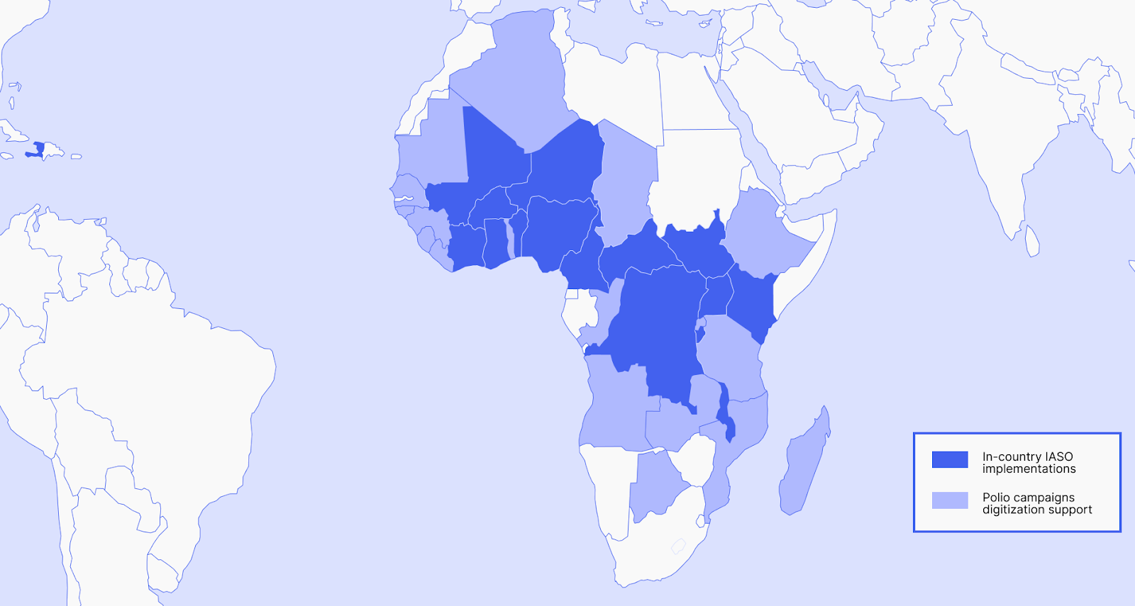
+25 organizations using IASO
+15 countries
3 multi-country projects
Recognition and Global Impact
In 2022, IASO’s innovation and impact were recognized on a global scale. It was acknowledged as a Digital Public Good by the Digital Public Alliance and a Global Good software by Digital Square. IASO’s open-source and versatile nature, coupled with its ability to handle multiple geo-data sources and operate offline, has made it a tool of choice for a wide range of governments and organizations across 25 projects. Burkina Faso has for example officially adopted IASO for Georegistry management in 2023.
Looking Ahead
As IASO continues to evolve, our focus remains on leveraging technology to address global health, environmental and social challenges. With a ton of planned enhancements and a growing community of users and contributors, IASO is poised to make even greater impacts in the years to come.
Join us in celebrating five years of innovation, growth, and impact. Here’s to the journey ahead and the many milestones yet to be achieved!


